Home > North America > Saint Pierre and Miquelon > Saint-Pierre
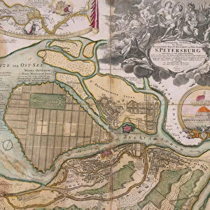
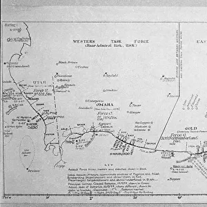
Map of Saint Petersburg, 1783. Creator: Tardieu, Pierre Francois (1752-1798)
")
![]()
Wall Art and Photo Gifts from Heritage Images
Map of Saint Petersburg, 1783. Creator: Tardieu, Pierre Francois (1752-1798)
Map of Saint Petersburg, 1783. Private Collection
Heritage Images features heritage image collections
Media ID 20763916
© Fine Art Images/Heritage Images
Cartography Petersburg Saint Petersburg Tardieu
FEATURES IN THESE COLLECTIONS
> Maps and Charts
> Related Images
> North America
> Saint Pierre and Miquelon
> Saint-Pierre
EDITORS COMMENTS
This print showcases a remarkable piece of history: the "Map of Saint Petersburg, 1783" created by Pierre Francois Tardieu. With its intricate details and exquisite craftsmanship, this map takes us back to the grandeur of 18th-century Russia. As we gaze upon this fine art image, we are transported to the streets and canals of Saint Petersburg during a time when it was still in its infancy as a city. The precision etching captures every alleyway, bridge, and landmark with astonishing accuracy, allowing us to explore the layout of this magnificent metropolis. Tardieu's expertise in cartography is evident in his meticulous rendering of the city's topography. From the majestic Neva River that gracefully meanders through the heart of Saint Petersburg to the elegant architecture that adorns its streets, every element on this map reflects both Tardieu's skill as an artist and his deep understanding of geography. Preserved within a private collection, this rare gem offers us a glimpse into an era long gone but not forgotten. It serves as a testament to human ingenuity and curiosity about our surroundings. As we admire this masterpiece from Fine Art Images/Heritage Images, let us appreciate how maps like these have shaped our understanding of cities throughout history – connecting people across time and space while preserving their stories for generations to come.
MADE IN THE USA
Safe Shipping with 30 Day Money Back Guarantee
FREE PERSONALISATION*
We are proud to offer a range of customisation features including Personalised Captions, Color Filters and Picture Zoom Tools
SECURE PAYMENTS
We happily accept a wide range of payment options so you can pay for the things you need in the way that is most convenient for you
* Options may vary by product and licensing agreement. Zoomed Pictures can be adjusted in the Cart.