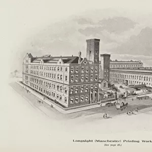
Home > Europe > United Kingdom > England > Manchester > Longsight
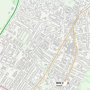
Manchester M13 0 Map

![]()
Wall Art and Photo Gifts from Map Marketing
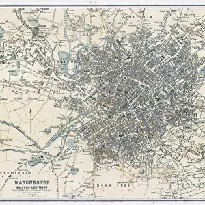
Manchester M13 0 Map
Postcode Sector Map of Manchester M13 0
Media ID 19975751
Albert Place Ash Grove Ashfield Road Beresford Road Birch Lane Buller Road Campbell Road Chelford Close Clarence Road Clitheroe Road Corn Close Denham Street Dickenson Road Duncan Road East Grove Fairview Avenue Hamilton Road Hawkhurst Road Keswick Close Kinross Road Lincoln Grove Lincoln Street Manchester Montgomery Road North Grove Oxford Place Palm Street Pine Grove Portland Crescent Portland Road Richmond Grove South Grove St Agnes Road Stamford Road Stockport Road Sunny Bank Road Tennyson Street The Boulevard West Grove Wheat Close York Place Infirmary Rusholme
FEATURES IN THESE COLLECTIONS
> Europe
> United Kingdom
> England
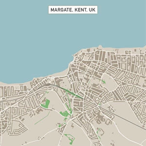
> Kent
> Grove
> Europe
> United Kingdom
> England
> Kent
> Halling
> Europe
> United Kingdom
> England
> Kent
> Hawkhurst
> Europe
> United Kingdom
> England
> Kent
> Kent Street
> Europe
> United Kingdom
> England
> Kent
> North Street
> Europe
> United Kingdom
> England
> Kent
> South Street
> Europe
> United Kingdom
> England
> Kent
> Upper Halling
> Europe
> United Kingdom
> England
> Kent
> West Street
> Europe
> United Kingdom
> England
> Manchester
> Longsight
> Europe
> United Kingdom
> England
> Manchester
> Manchester
> Map Marketing
> Postcode Sector Maps
> M - Manchester
MADE IN THE USA
Safe Shipping with 30 Day Money Back Guarantee
FREE PERSONALISATION*
We are proud to offer a range of customisation features including Personalised Captions, Color Filters and Picture Zoom Tools
SECURE PAYMENTS
We happily accept a wide range of payment options so you can pay for the things you need in the way that is most convenient for you
* Options may vary by product and licensing agreement. Zoomed Pictures can be adjusted in the Cart.